Relative Elevation Model (REM)
Digital Surface Model of Nationaalpark De Biesbosch
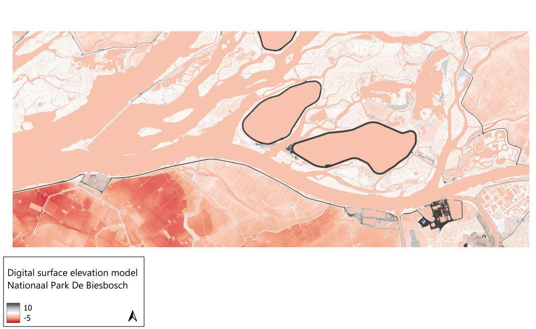
This elevation model map is created using QGIS and in particular is a Digital Surface Model (DSM). A DSM captures the elevation of the Earth's surface, including all natural and human-made features such as buildings, trees, and other structures. Unlike a Digital Elevation Model (DEM), which shows the bare ground surface by removing all surface objects, a DSM provides a comprehensive 3D representation of the terrain as it is captured by remote sensing technologies like LiDAR. Elevation models, including DSMs, are used for urban planning, forestry management and environmental studies. The models can help in assessing building heights, forest canopy structures and flood impact analysis.
The model I created shows the relative elevation compared to the elevation to the river, and visualizes dikes and also areas that are at a lower elevation level than the river. Especially in the Netherlands where much of the country lies below the sealevel it is important to study elevation to plan dams or dikes and prevent flooding.