3D City Map with LiDAR data
Creating a comparison map for Sustainble Development Goals
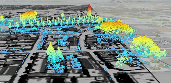
This screenshot shows a 3D scene I created of Utrecht, using publicly available LiDAR data that was collected in November 2023 by the Optical and Laser Remote Sensing group of the Department of Geoscience and Remote Sensing at the Delft University of Technology.
LiDAR (Light Detection and Ranging) data is a remote sensing method that uses laser pulses to measure distances to the Earth's surface, to give accurate topographic information. 3D maps are important because they provide a representation of the terrain and structures, which is useful for urban planning, environmental monitoring, and disaster management.
When developing this scene, I learned to convert data files from LAZ to LAS, understand the importance of coordinate systems (x, y, z), measure the height of trees and buildings, and create profile views. These skills are crucial for interpreting and using geospatial data.
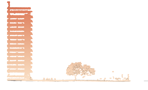
Screenshot of a profile view.